 https://www.synyo.com/wp-content/uploads/SYNYO-NEWS-featured-image-NEW01009401EN.png
400
459
leo
https://www.synyo.com/wp-content/uploads/2017/09/synyo-logo.png
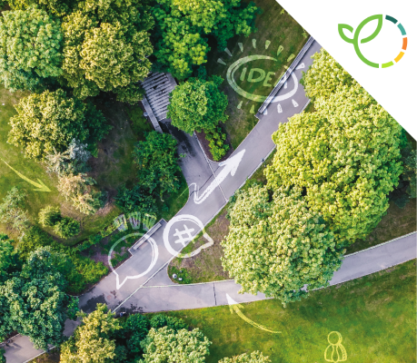
leo2026-02-01 13:41:502026-02-03 10:18:50GreenEsteem: Project for sustainable Nature-Based Solutions through Co-Creation Launched
https://www.synyo.com/wp-content/uploads/SYNYO-NEWS-featured-image-NEW01009401EN.png
400
459
leo
https://www.synyo.com/wp-content/uploads/2017/09/synyo-logo.png
leo2026-02-01 13:41:502026-02-03 10:18:50GreenEsteem: Project for sustainable Nature-Based Solutions through Co-Creation LaunchedeMAPs
eMAPs: Final steps in revolutionizing urban mobility and agriculture with advanced GNSS Solutions
The eMAPs project is transforming urban mobility and agriculture with GNSS solutions powered by Galileo data. Offering 30cm accuracy, it supports smart navigation, public transport management, precision viticulture, and infrastructure monitoring, delivering essential tools to advance smarter cities and sustainable practices.
The eMAPs project has spearheaded the development of cutting-edge GNSS-based solutions addressing diverse sectors, including agriculture and urban mobility. For this purpose, an innovative, low-cost, and high-performance GNSS receiver was developed, leveraging Galileo data to address current challenges in these sectors. GaliGo, a mobility solution under eMAPs, focuses on smart city transportation by providing sustainable and efficient travel options. The solution integrates multi-frequency GNSS, inertial measurement units (IMUs), and cameras to deliver 30cm positioning accuracy and high-definition urban maps. Targeted applications include smart navigation for connected cars, real-time fleet management for public transport, and infrastructure monitoring for urban planners. Coordinated by 3D Aerospace SASU, the project involved the partners SYNYO, École nationale de l’aviation civile, and Université Gustave Eiffel, focusing on scalability, real-time map updates, and precision, benefiting travellers, transport operators, and urban authorities. Key aspects and achievements of eMAPs for the mobility sector included:
- Targeted Applications: Smart navigation for connected cars, real-time fleet management for public transport operators as well as infrastructure monitoring for urban planners.
- Innovative Features: A low-cost, cloud-based platform combining GNSS, IMUs, and cameras, offering cm-level accuracy, scalability, and near real-time updates.
- Prototype testing: Test vehicles equipped with a reference trajectory system validated the receiver’s performance.
- Collaboration and Impact: Benefits extend to travellers, transport operators, and urban authorities by enhancing precision and usability.
Similarly, eMaps developed GNSS-based tools to support the agricultural sector. DeVines, a technological solution for smart viticulture, integrates the high-tech GNSS receiver eHermes with big data analytics and 3D mapping to enhance vineyard management. This system provides real-time decimetric positioning, continuous grape growth monitoring, and rapid anomaly detection while streamlining management processes. It tracks performance indicators like grape count per plant and leaf density and features a smartphone app for geolocating and reporting vineyard issues.
In the scope of this 24-month project, the consortium achieved vital progress and realized a low-cost, cloud-based mass-market platform, which hybridizes data generated by a multi- frequency GNSS receiver, demonstrating the versatility and impact of GNSS technology to bring important innovations to diverse sectors.
Links
eMAPs Project Website: https://www.emaps.eu/
DeVines Infosite: https://www.emaps.eu/devines/
GaliGo Infosite: https://www.emaps.eu/galigo/
Keywords
Viticulture, Vineyard management, wine growing; Global Navigation Satellite System (GNSS), Galileo, disruptive Localisation Based Service (LBS)
https://www.synyo.com/wp-content/uploads/SYNYO-NEWS-featured-image-NEW01009401EN.png
400
459
leo
https://www.synyo.com/wp-content/uploads/2017/09/synyo-logo.png
leo2026-02-01 13:41:502026-02-03 10:18:50GreenEsteem: Project for sustainable Nature-Based Solutions through Co-Creation Launched https://www.synyo.com/wp-content/uploads/SYNYO-NEWS-featured-image-Press-Release.png
400
459
leo
https://www.synyo.com/wp-content/uploads/2017/09/synyo-logo.png
leo2025-12-15 09:55:062025-12-18 09:55:28ReIncluGen: European Research Project Maps New Ways to Strengthen Support for Migrant Women
https://www.synyo.com/wp-content/uploads/SYNYO-NEWS-featured-image-Press-Release.png
400
459
leo
https://www.synyo.com/wp-content/uploads/2017/09/synyo-logo.png
leo2025-12-15 09:55:062025-12-18 09:55:28ReIncluGen: European Research Project Maps New Ways to Strengthen Support for Migrant Women https://www.synyo.com/wp-content/uploads/SYNYO-NEWS-featured-image-NEW01009002EN.png
400
459
leo
https://www.synyo.com/wp-content/uploads/2017/09/synyo-logo.png
leo2025-08-01 13:48:032025-10-20 13:50:29METEOR Programme development and work package and outreach updates
https://www.synyo.com/wp-content/uploads/SYNYO-NEWS-featured-image-NEW01009002EN.png
400
459
leo
https://www.synyo.com/wp-content/uploads/2017/09/synyo-logo.png
leo2025-08-01 13:48:032025-10-20 13:50:29METEOR Programme development and work package and outreach updatesLatest News
 GreenEsteem: Project for sustainable Nature-Based Solutions through Co-Creation LaunchedFebruary 1, 2026 - 1:41 pm
 ReIncluGen: European Research Project Maps New Ways to Strengthen Support for Migrant WomenDecember 15, 2025 - 9:55 am
 METEOR Programme development and work package and outreach updatesAugust 1, 2025 - 1:48 pm

