 https://www.synyo.com/wp-content/uploads/SYNYO-NEWS-featured-image-NEW01009401EN.png
400
459
leo
https://www.synyo.com/wp-content/uploads/2017/09/synyo-logo.png
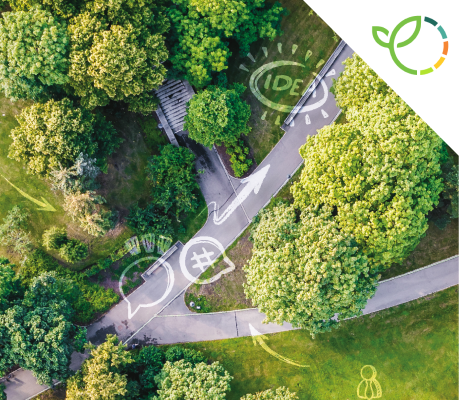
leo2026-02-01 13:41:502026-02-03 10:18:50GreenEsteem: Project for sustainable Nature-Based Solutions through Co-Creation Launched
https://www.synyo.com/wp-content/uploads/SYNYO-NEWS-featured-image-NEW01009401EN.png
400
459
leo
https://www.synyo.com/wp-content/uploads/2017/09/synyo-logo.png
leo2026-02-01 13:41:502026-02-03 10:18:50GreenEsteem: Project for sustainable Nature-Based Solutions through Co-Creation LaunchedeMAPs
eMAPs: eHermes receiver tested to optimize the wine growing practices for the challenges of tomorrow
Over the last couple of months, eMAPs has developed a highly-accurate GNSS receiver (Global Navigation
Satellite receiver), which will enhance the current state of the art of similar models on the market. The solution
has now been demonstrated for its use in enhancing wine growing practices to meet economic, environmental
and vineyard maintenance challenges – and therefore merges viticulture with technology.
As of today, the world of viticulture faces many problems related to the growth of wines, the environment, and
the management of remote resources. These issues can accumulate and potentially slow down production as a
whole when left unaddressed. Typical challenges are (i) economical, linked to operating performance, (ii)
environmental, linked to climate change as well as (iii) are related to vineyards maintenance challenges, due to
remote employee management.
GNSS receiver to meet challenges of vineyard owners
The eMAPs project has developed a GNSS receiver, which can be used to meet all of these challenges. The
presented solution for vineyard owners is called DeVines and can help winegrowers to accurately monitor the
growth of their grapes in the parcels, while also enhancing human resource management, productivity and
communication through the DeVines mobile application.
The fusion of tradition and precision viticulture takes place using a novel eHermes receiver, together with the
DeVines mobile application, a database as link between the receiver and mobile application as well as the Galileo
& GPS satellites, which are used to geolocate the eHermes receivers. The receivers can be retrofitted on any type
of tractors and are mapping the vineyard thanks to its seven cameras. Based on the collected data, the DeVines
mobile application is creating High-Definition maps which are made available through the application to allow
users to precisely geolocate anomalies.
Advantages of the DeVines solution
A continuous tracking of growth of the vineyard ́s grapes and the detection of vineyard anomalies will help to
establish a leaner vineyard management system. Qualitative and quantitative data will be continuously gathered
from multiple sources and sensors, helping to track a variety of KPIs such as the number of grapes per plant, the
grapes and plants’ growth, the leaf density and missing plants. The smartphone application provides an interface
for real-time communication between managers, employees and contractors across the vineyard. The
application allows users to manually record the geolocation of any anomalies they observe. Flagged anomalies
are then pictured, timestamped and geotagged, so that managers can visualize them in a matter of seconds.
Eventually, the DeVines solution helps vineyard owners to better plan their day (by allocating tasks to employees
on a regular basis), to monitor all activities in the vineyard and to analyse all ongoing developments in the
vineyard. Further advancements will be made to it, as currently it is being tested by vineyard owners and will
then be made available to all interested customers.
Links
eMAPs Projectwebsite: https://www.emaps.eu/
DeVines Infosite: https://www.emaps.eu/devines/
Keywords
Viticulture, Vineyard management, wine growing; Global Navigation Satellite System (GNSS), Galileo, disruptive
Localisation Based Service (LBS)
https://www.synyo.com/wp-content/uploads/SYNYO-NEWS-featured-image-NEW01009401EN.png
400
459
leo
https://www.synyo.com/wp-content/uploads/2017/09/synyo-logo.png
leo2026-02-01 13:41:502026-02-03 10:18:50GreenEsteem: Project for sustainable Nature-Based Solutions through Co-Creation Launched https://www.synyo.com/wp-content/uploads/SYNYO-NEWS-featured-image-Press-Release.png
400
459
leo
https://www.synyo.com/wp-content/uploads/2017/09/synyo-logo.png
leo2025-12-15 09:55:062025-12-18 09:55:28ReIncluGen: European Research Project Maps New Ways to Strengthen Support for Migrant Women
https://www.synyo.com/wp-content/uploads/SYNYO-NEWS-featured-image-Press-Release.png
400
459
leo
https://www.synyo.com/wp-content/uploads/2017/09/synyo-logo.png
leo2025-12-15 09:55:062025-12-18 09:55:28ReIncluGen: European Research Project Maps New Ways to Strengthen Support for Migrant Women https://www.synyo.com/wp-content/uploads/SYNYO-NEWS-featured-image-NEW01009002EN.png
400
459
leo
https://www.synyo.com/wp-content/uploads/2017/09/synyo-logo.png
leo2025-08-01 13:48:032025-10-20 13:50:29METEOR Programme development and work package and outreach updates
https://www.synyo.com/wp-content/uploads/SYNYO-NEWS-featured-image-NEW01009002EN.png
400
459
leo
https://www.synyo.com/wp-content/uploads/2017/09/synyo-logo.png
leo2025-08-01 13:48:032025-10-20 13:50:29METEOR Programme development and work package and outreach updatesLatest News
 GreenEsteem: Project for sustainable Nature-Based Solutions through Co-Creation LaunchedFebruary 1, 2026 - 1:41 pm
 ReIncluGen: European Research Project Maps New Ways to Strengthen Support for Migrant WomenDecember 15, 2025 - 9:55 am
 METEOR Programme development and work package and outreach updatesAugust 1, 2025 - 1:48 pm

