 https://www.synyo.com/wp-content/uploads/SYNYO-NEWS-featured-image-NEW01009401EN.png
400
459
leo
https://www.synyo.com/wp-content/uploads/2017/09/synyo-logo.png
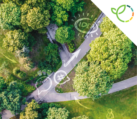
leo2026-02-01 13:41:502026-02-03 10:18:50GreenEsteem: Project for sustainable Nature-Based Solutions through Co-Creation Launched
https://www.synyo.com/wp-content/uploads/SYNYO-NEWS-featured-image-NEW01009401EN.png
400
459
leo
https://www.synyo.com/wp-content/uploads/2017/09/synyo-logo.png
leo2026-02-01 13:41:502026-02-03 10:18:50GreenEsteem: Project for sustainable Nature-Based Solutions through Co-Creation LaunchedeMAPs
eMAPs: New use case on smart urban mobility to reduce carbon footprint
eMAPs has developed a highly-accurate GNSS receiver (Global navigation satellite receiver) to enhance the current state-of-the-art of similar models on the market. With GaliGo, it is demonstrating it´s potential in the field of smart urban mobility, supporting urban authorities, carrier customers, carriers as well as transporters. Among other benefits, the solution will help to reduce congestion, safety as well as customer satisfaction.
The eMAPs consortium has developed a disruptive Localisation Based Service (LBS) in its Galileo-based project, to tackle the foreseen and expected smart city and autonomous car challenges. The hardware and software developments of the project aim at providing future solutions such as smart navigation for connected car users, real time fleet management for city public transport and infrastructure maintenance monitoring for city planners. By developing an innovative, low-cost, compact, high performance receiver, eMAPs provides a targeted 30cm vehicle’s position accuracy and high-definition urban maps which will benefit to all smart cities’ stakeholder groups: the travellers, the public transport operators and the urban authorities.
GaliGo: An enabler of smart mobility in urban cities
With GaliGo, a first use case has now been defined for the use of the receiver. GaliGo aims to answer the question on how to enable smart mobility in urban cities while reducing carbon footprint. The smartphone application will be connected to the receiver and offers real-time navigation, geotagged information, connected maps as well as will serve as a main interface with customers with customized application and an online assessment. Urban authorities will therewith be enabled to reduce congestion, improve road safety as well as air quality in their cities.

Figure 1: GaliGo Smartphone Application
The specific added-value of the GaliGo smartphone application lies in the ability to provide real-time connected transport, real-time navigation on the road, real-time navigation from home and last-mile matching. A database will be powered by the receiver data and will be connected to a specific database, which will be powered by the receiver data. The, therewith achieved, dynamic optimisation of urban navigation will help to decrease urban congestion and equip public transport with a multitude of information, which will be visualized in a real-time HD urban map.
Further use cases will be presented
Besides GaliGo, further use-cases will be developed and described in detail within the eMAPs project. One of them will be DeVines, which is focusing on the use of the eHermes receiver in the field of winegrowing (viticulture). The fusion of tradition and precision viticulture will be one major outcome of the eMAPs project and will enhance human resource management, productivity and communication within the vineyard.
Links
eMAPs projectwebsite: www.emaps.eu
Keywords
Global Navigation Satellite System (GNSS), Galileo, Disruptive Localization Based Service (LBS), Smart Urban Mobility
https://www.synyo.com/wp-content/uploads/SYNYO-NEWS-featured-image-NEW01009401EN.png
400
459
leo
https://www.synyo.com/wp-content/uploads/2017/09/synyo-logo.png
leo2026-02-01 13:41:502026-02-03 10:18:50GreenEsteem: Project for sustainable Nature-Based Solutions through Co-Creation Launched https://www.synyo.com/wp-content/uploads/SYNYO-NEWS-featured-image-Press-Release.png
400
459
leo
https://www.synyo.com/wp-content/uploads/2017/09/synyo-logo.png
leo2025-12-15 09:55:062025-12-18 09:55:28ReIncluGen: European Research Project Maps New Ways to Strengthen Support for Migrant Women
https://www.synyo.com/wp-content/uploads/SYNYO-NEWS-featured-image-Press-Release.png
400
459
leo
https://www.synyo.com/wp-content/uploads/2017/09/synyo-logo.png
leo2025-12-15 09:55:062025-12-18 09:55:28ReIncluGen: European Research Project Maps New Ways to Strengthen Support for Migrant Women https://www.synyo.com/wp-content/uploads/SYNYO-NEWS-featured-image-NEW01009002EN.png
400
459
leo
https://www.synyo.com/wp-content/uploads/2017/09/synyo-logo.png
leo2025-08-01 13:48:032025-10-20 13:50:29METEOR Programme development and work package and outreach updates
https://www.synyo.com/wp-content/uploads/SYNYO-NEWS-featured-image-NEW01009002EN.png
400
459
leo
https://www.synyo.com/wp-content/uploads/2017/09/synyo-logo.png
leo2025-08-01 13:48:032025-10-20 13:50:29METEOR Programme development and work package and outreach updatesLatest News
 GreenEsteem: Project for sustainable Nature-Based Solutions through Co-Creation LaunchedFebruary 1, 2026 - 1:41 pm
 ReIncluGen: European Research Project Maps New Ways to Strengthen Support for Migrant WomenDecember 15, 2025 - 9:55 am
 METEOR Programme development and work package and outreach updatesAugust 1, 2025 - 1:48 pm

