 https://www.synyo.com/wp-content/uploads/SYNYO-NEWS-featured-image-NEW01009401EN.png
400
459
leo
https://www.synyo.com/wp-content/uploads/2017/09/synyo-logo.png
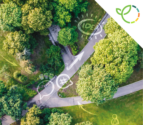
leo2026-02-01 13:41:502026-02-03 10:18:50GreenEsteem: Project for sustainable Nature-Based Solutions through Co-Creation Launched
https://www.synyo.com/wp-content/uploads/SYNYO-NEWS-featured-image-NEW01009401EN.png
400
459
leo
https://www.synyo.com/wp-content/uploads/2017/09/synyo-logo.png
leo2026-02-01 13:41:502026-02-03 10:18:50GreenEsteem: Project for sustainable Nature-Based Solutions through Co-Creation LaunchedeMAPs
eMAPs: Project towards a new satellite navigation device for smart and accurate mobility
Higher accuracy and availability of GNSS – receivers (Global Navigation Satellite System receivers) are key, to enhance current navigation systems. The change of cities´ architecture makes the usage of GNSS signals challenging due to the inaccuracy introduced by multipath phenomena (one of the most common errors in GNSS receivers, caused by reflection from nearby obstacles). The eMAPs project will address these current shortcomings and aims to develop a novel, highly-accurate GNSS receiver for the mass-market.
Background
According to a United Nations’ report, World Urbanization Prospects, the number of cities with at least one million inhabitants is forecasted to increase from 512 cities worldwide in 2016 to 662 cities in 2030 (a 29% increase). As the global urban population is growing steady, it brings a number of challenges that cities will have to face such as traffic management, infrastructure maintenance and air quality monitoring.
Alongside with the development of denser cities, the demands by GNSS end users for higher accuracy, availability, robustness and integrity are continuously increasing. These GNSS receivers are essential devices for geographical positioning, and – in combination with suitable software – are key for enhanced routing and navigation. Most of the platforms used in TomTom cars as well as by Google or HERE are built up by the addition of the different sensor elements (GNSS antenna, IMU block, LiDAR and cameras). This straightforward integration method makes these devices heavy, very expensive, bulky and environmentally unfriendly (due to significant drag coefficient). Hence, these are not mass-market compatible.
The eMAPs project
eMAPs will develop an enhanced GNSS receiver, based on a disruptive Localisation Based Service (LBS) using Galileo data, to tackle the foreseen and expected smart city and autonomous car challenges. The hardware and software developments of eMAPs aim at providing future solutions such as smart navigation for connected car users, real time fleet management for city public transport and infrastructure maintenance monitoring for city planners. By developing an innovative, low-cost, compact, high performance premium receiver, eMAPs will provide a targeted 30cm vehicle’s position accuracy and high-definition urban maps which will benefit to all smart cities’ stakeholder groups: the travellers, the public transport operators and the urban authorities. Specifically, eMAPs will:
- Provide future solutions such as smart navigation for connected car users, fleet management for city public transport as well as maintenance monitoring for city planners
- Develop a low-cost, cloud-based multi-sensor premium mass market platform which will hybridize data generated by a multi-frequency multi-constellation GNSS receiver, an IMU and cameras
- Test the developed prototype, using test vehicles equipped with a reference trajectory system to obtain exact positioning with cm-level accuracy
- Enhance scalability, near real time map updates and higher accuracy to new users, which cannot be met by the current business model
Under the coordination of the French company 3D Aerospace SASU, the partners SYNYO, École nationale de l’aviation civile and Université Gustave Eiffel, the consortium will work together in this 24-month project towards the realization of its low-cost, cloud-based mass-market platform, which will hybridize data generated by a multi-frequency GNSS receiver. More information on the first outcomes of the project can be found soon at: www.emaps.eu
Links
eMAPs Projectwebsite: https://www.emaps.eu/
Keywords
Global Navigation Satellite System (GNSS), Galileo, disruptive Localisation Based service (LBS)
https://www.synyo.com/wp-content/uploads/SYNYO-NEWS-featured-image-NEW01009401EN.png
400
459
leo
https://www.synyo.com/wp-content/uploads/2017/09/synyo-logo.png
leo2026-02-01 13:41:502026-02-03 10:18:50GreenEsteem: Project for sustainable Nature-Based Solutions through Co-Creation Launched https://www.synyo.com/wp-content/uploads/SYNYO-NEWS-featured-image-Press-Release.png
400
459
leo
https://www.synyo.com/wp-content/uploads/2017/09/synyo-logo.png
leo2025-12-15 09:55:062025-12-18 09:55:28ReIncluGen: European Research Project Maps New Ways to Strengthen Support for Migrant Women
https://www.synyo.com/wp-content/uploads/SYNYO-NEWS-featured-image-Press-Release.png
400
459
leo
https://www.synyo.com/wp-content/uploads/2017/09/synyo-logo.png
leo2025-12-15 09:55:062025-12-18 09:55:28ReIncluGen: European Research Project Maps New Ways to Strengthen Support for Migrant Women https://www.synyo.com/wp-content/uploads/SYNYO-NEWS-featured-image-NEW01009002EN.png
400
459
leo
https://www.synyo.com/wp-content/uploads/2017/09/synyo-logo.png
leo2025-08-01 13:48:032025-10-20 13:50:29METEOR Programme development and work package and outreach updates
https://www.synyo.com/wp-content/uploads/SYNYO-NEWS-featured-image-NEW01009002EN.png
400
459
leo
https://www.synyo.com/wp-content/uploads/2017/09/synyo-logo.png
leo2025-08-01 13:48:032025-10-20 13:50:29METEOR Programme development and work package and outreach updatesLatest News
 GreenEsteem: Project for sustainable Nature-Based Solutions through Co-Creation LaunchedFebruary 1, 2026 - 1:41 pm
 ReIncluGen: European Research Project Maps New Ways to Strengthen Support for Migrant WomenDecember 15, 2025 - 9:55 am
 METEOR Programme development and work package and outreach updatesAugust 1, 2025 - 1:48 pm

